![]()
![]()
![]()
|
|
VIRGINIA AND NORTH CAROLINA BOUNDARY LINE by Mary M. Root The boundary line between Virginia and North Carolina was in dispute for many years. The survey of 1710-1711 was marred by flawed equipment and observations, and dissension between the two colonies' representatives. This culminated in a 15 mile dead zone (north to south) wherein settlement was prohibited by both jurisdictions. Finally, in 1715, colonial governors Spotswood of Virginia and Eden of North Carolina decided upon the salient points of the boundary, agreeing that the line should begin on the north side of the Currituck Inlet and run "Due West" from there. This agreement had to be approved by councils of both colonies and then ratified by the proprietors of Carolina, the English Privy Council, and King George I, so it was not until 1728 that the actual survey was begun. Commissioners and surveyors were appointed to represent each colony's interests. The seven commissioners' duties included arbitrating disputes, hiring labor, provisioning and mounting each person on the expedition, maintaining base-camps, and the summarizing and signing of an official report. The four surveyors were responsible for running the boundary, supervising the survey party, and preparing maps and descriptions of the work. The rest of the party consisted of "chain-carriers", "markers", woodsmen, and horse and baggage handlers.
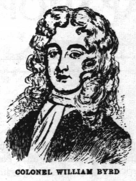
Because of this difference in intended audiences, Byrd toned down his scathing remarks about the North Carolinians, and omitted the arguments between commissioners on his History of the Line. In the Secret History of the Line, Byrd revealed an expedition beset by constant quarrels and difficulties. Their first argument was over the point of beginning; the location and the ensuing latitude of 36 31' 00" on the north side of Currituck Inlet. (Much later, surveys of the United States Coastal & Geodetic Survey showed that the latitude of Currituck Inlet was 36 33'15", while the western end near Bristol, Tennessee was 36 34' 25.5"). Here Byrd invoked a decree made in Virginia's favor - "the right to determine the boundary"s course by themselves if the North Carolinians failed to cooperate fully in the project" - and further declared the latitude a moot point due to their instructions ("Due West from Currituck"). There were two surveyors from each colony on this project. The North Carolinians were Edward Mosely (also an NC Commissioner), and Samuel Swann. The Virginians were Alexander Irvine and William Mayo. These appointments did little to lessen tensions on the team. Edward Mosely was both North Carolina commissioner and surveyor on the embarrassing expedition of 1710. Samuel Swann was Moseley's nephew and according to Byrd, was "a Young Man of much Industry, but no Experience". Alexander Irvine was a professor of mathematics at William & Mary, yet had no experience in surveying, so that he often seemed "grievously puzzled about Plotting off his Surveyor's Work". William Mayo had already achieved critical acclaim in England for his survey and map of Barbados; Byrd's diary referred to him as "honest Astrolabe". The next of their difficulties lay in the terrain. The sandy shores of the Atlantic Ocean soon gave way to miry marshes with razor-sharp grasses. Next came the "poquosin", an Algonquian term for the low wooded ground, covered with water, which was irregularly broken by unseen channels of deeper water. Finally they were at the edge of the Dismal Swamp, of which Byrd wrote: "The Reeds which grew about 12 feet high, were so thick, & so interlaced with Bamboe-Briars, that our Pioneers were forc't to open a Passage. The Ground, if I may properly call it so, was so Spungy, that the Prints of our Feet were instantly fill'd with Water. But the greatest Grievance was from large Cypresses, which the Wind had blown down and heap'd upon one another. On the Limbs of most of them grew Sharp Snags, Pointing every way like so many Pikes, that requir'd much Pains and Caution to avoid". As the survey progressed, tensions between the surveyors increased; Irvine ("Orion") perceived that the credit for the success of the survey would be attributed to Mayo's leadership and surveying experience. Irvine took his complaints to Virginia Commissioner Richard FitzWilliam ("Firebrand"), touching off a new round of arguments between all the commissioners. Byrd wrote: "I was weak enough to be as loud and Cholerick as he... After this Storm was over Firebrand went with Shoebrush to Mr. Oshields for some Days, and his going off was not less pleasing to us than the going off of a Fever". Despite the turmoil and hardships, 73 miles of the Line was surveyed using compass and chain, in March and April of 1728. Later, in the autumn of the same year, the group returned to press the Line another 100 miles before the North Carolinians decided that was enough. After a great deal of controversy that nearly came to fisticuffs, the North Carolinians and Va. Commissioner FitzWilliam left for home. Byrd and his contingent prepared a letter to the Virginia governor and to his Majesty's representatives, explaining their reasons for carrying on the survey. They continued the Line another 64 miles to the foothills of the Appalachian mountains. This survey was accepted by King George I and his Council; all objections made by the Carolinians were overruled. Back in the colonies, the implications were evident to landowners. As Byrd wrote: "The Line cut William Spight's Plantation in two, leaving little more than his dwelling House and Orchard in Virginia. Sundry other Plantations were Split in the same unlucky Manner, which made the Owners accountable to both Governments. Wherever we passed we constantly found the Borderers laid it to Heart if their Land was taken into Virginia: They chose much rather to belong to Carolina, where they pay no Tribute, either to God or to Caesar". Private landowner's woes notwithstanding, the boundary was in place. FURTHER READING: Byrd, William. Histories of the Dividing Line Betwixt Virginia and North Carolina. Introduction & Notes by William K. Boyd. New York: Dover Publications, 1967. Byrd, William. The London Diary 1717-1721 And Other Writings. Edited by Louis B. Wright & Marion Tinling. New York: Oxford University Press, 1958. Dabney, Virginius. Virginia, The New Dominion. New York: Doubleday & Co., Inc., 1978. Early, R.H. By-Ways of Virginia History. Richmond, Virginia: Everett Waddey Co., 1907. Fiske, John. Old Virginia and Her Neighbors. Vol. II. Boston: The Riverside Press, 1897. Hughes, Sarah. Surveyors & Statesmen. Richmond, Virginia: The Virginia Association of Surveyors, 1979. Marambaud, Pierre. "William Byrd of Westover - Cavalier, Diarist, and Chronicler". The Virginia Magazine of History and Biography. 78:2 (April 1970), 144-183. Swem, Earl G. Maps Relating to Virginia. Richmond, Virginia: Virginia State Library & Archives, 1989.
|
|
|